Site Plan
Our twenty-four units are clustered in four smaller "neighborhoods" which cover five of the 20 acres here. About half of the units are single family and the other half are attached (one triplex and the rest duplex). The architecture is simple, traditional New England, with wood siding. One unit in the triplex was the original farmhouse. The houses as designed range from 1200 sf to 2200 sf, and from two to four bedrooms, but due to customizations and attic or basement renovations, many are larger than the designed base plan.
The houses are arranged in clusters around the Common House and common pedestrian space, and surrounded by meadows and woods. The landscape is designed to encourage connections between neighbors, with cars parked on the periphery and mailboxes located in the Common House.
The houses are arranged in clusters around the Common House and common pedestrian space, and surrounded by meadows and woods. The landscape is designed to encourage connections between neighbors, with cars parked on the periphery and mailboxes located in the Common House.
|
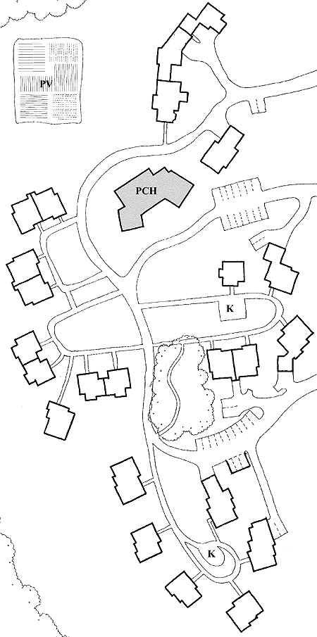
To the right is a somewhat dated site plan, but it offers a simplified view of the site.
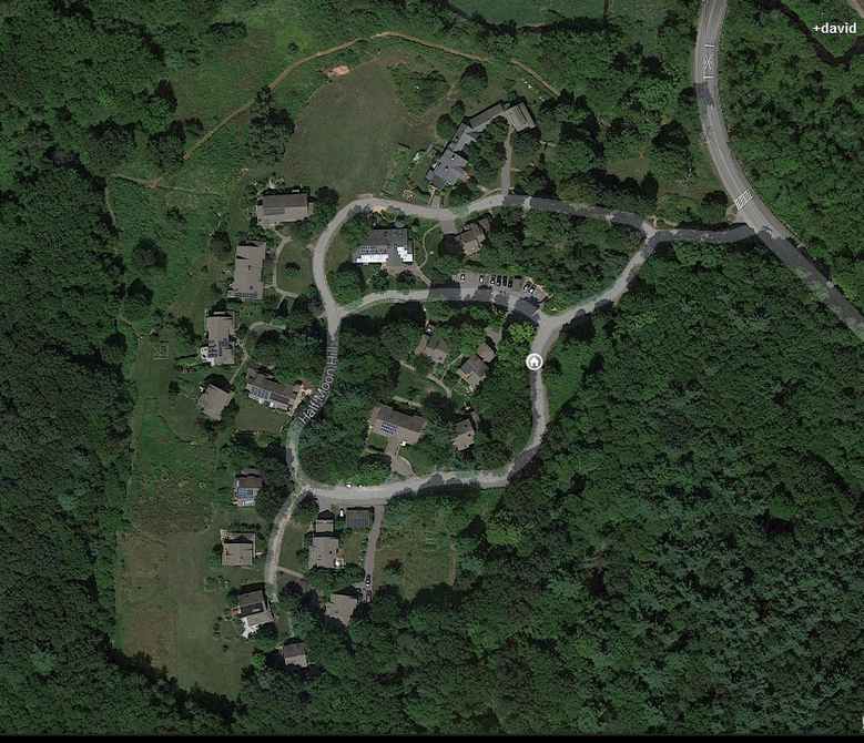
The site slopes up from the top of this page (North) to the bottom of the page (South). The skinny double lines are sidewalks, the wider ones that connect to parking areas are roads. But most of the roads are off-limits to cars, except for deliveries and emergencies. The main car road - Half Moon Hill - is not drawn: it's off to the right. Just under half the houses - those on the right-hand side - have parking at or very near their houses. The houses on the left half are in the pedestrian zone; cars are parked in the common parking areas. PCH stands for 'Proposed Common House' - there's a real one there now, a bit smaller and differently shaped than the one drawn. Learn more about our Common House. PV stands for "Proposed Vegetable Garden" - that's real now too, but it is smaller and closer to the Common House than drawn here. The area marked as PV is now a large grass field, where pick-up soccer games and the like take place. Town of Acton conservation land lies to the south, west and east of the site (Guggins Brook and Wright Hill). To the north, across a brook, are Idylwilde Farm's fields. A more detailed site plan is found here. Here is the Google Maps view of the site. The shiny bits in the center are the solar panels on the Common House roof.
|
|